


Algorithms for Object Detection and Tracking Using Lidar Data
Lidar is one of the most reliable sensors used for robotics perception and autonomous navigation. Its output can be used for both self-awareness and situational awareness. For example, a lidar point cloud can be processed to estimate the ego vehicle’s motion and detect and track nearby objects.
View the full tutorial playlist: https://www.youtube.com/playlist?list=PLn8PRpmsu08pmfVJLf19LO6Z-FXbwR77V
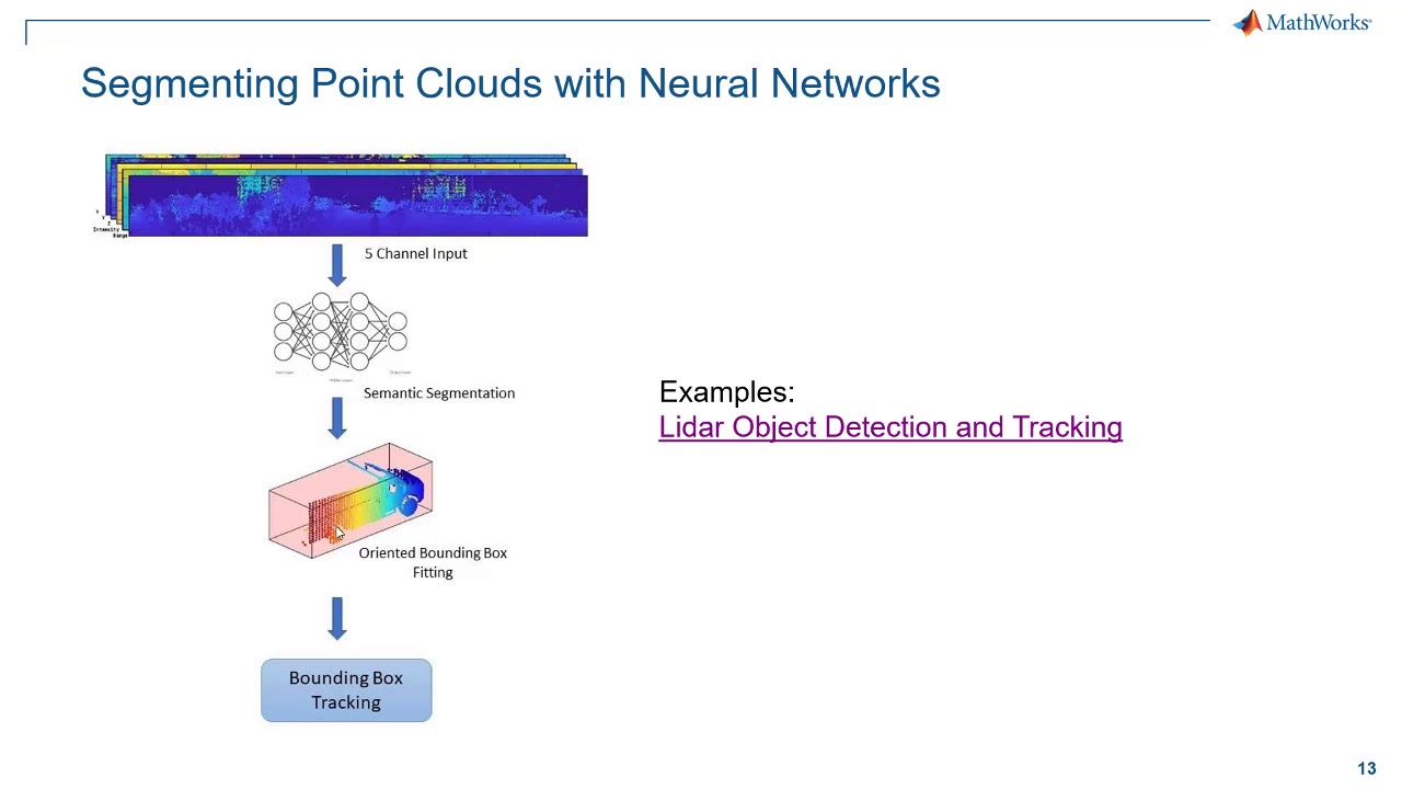
In this video, the presenter walks you through two examples that show how to detect, classify, and track vehicles by using lidar point cloud data captured by a lidar sensor mounted on an ego vehicle.
The lidar data is recorded from a highway-driving scenario. The examples illustrate the workflow in MATLAB® for processing the point cloud and tracking the objects. The point cloud data is segmented to determine the class of objects using the PointSeg network. A joint probabilistic data association (JPDA) tracker with an interactive multiple model (IMM) filter is used to track the detected vehicles.
——————————————————————————————————–
Get a free product trial: https://goo.gl/ZHFb5u
Learn more about MATLAB: https://goo.gl/8QV7ZZ
Learn more about Simulink: https://goo.gl/nqnbLe
See what’s new in MATLAB and Simulink: https://goo.gl/pgGtod
© 2020 The MathWorks, Inc. MATLAB and Simulink are registered trademarks of The MathWorks, Inc.
See www.mathworks.com/trademarks for a list of additional trademarks. Other product or brand names may be trademarks or registered trademarks of their respective holders.
source