


ELISE Webinar: Geospatial Data and Artificial Intelligence – a deep dive into GeoAI
What is the potential of Artificial Intelligence (AI) for geospatial thinking and how can geospatial data contribute to the momentum of AI?
This webinar will take a deep dive into the expanding field of GeoAI, by exploring a number of key advancements within AI technologies and demonstrating their current application and relevance in central public policy areas.
In this webinar, Dhananjay Ipparthi – a specialist in the field of AI, Sebastiaan van der Peijl and Lea Ytrehus from Deloitte Belgium will present the current state of play on GeoAI and the potential of this domain for geospatial thinking and public policy.
This webinar will cover more specifically:
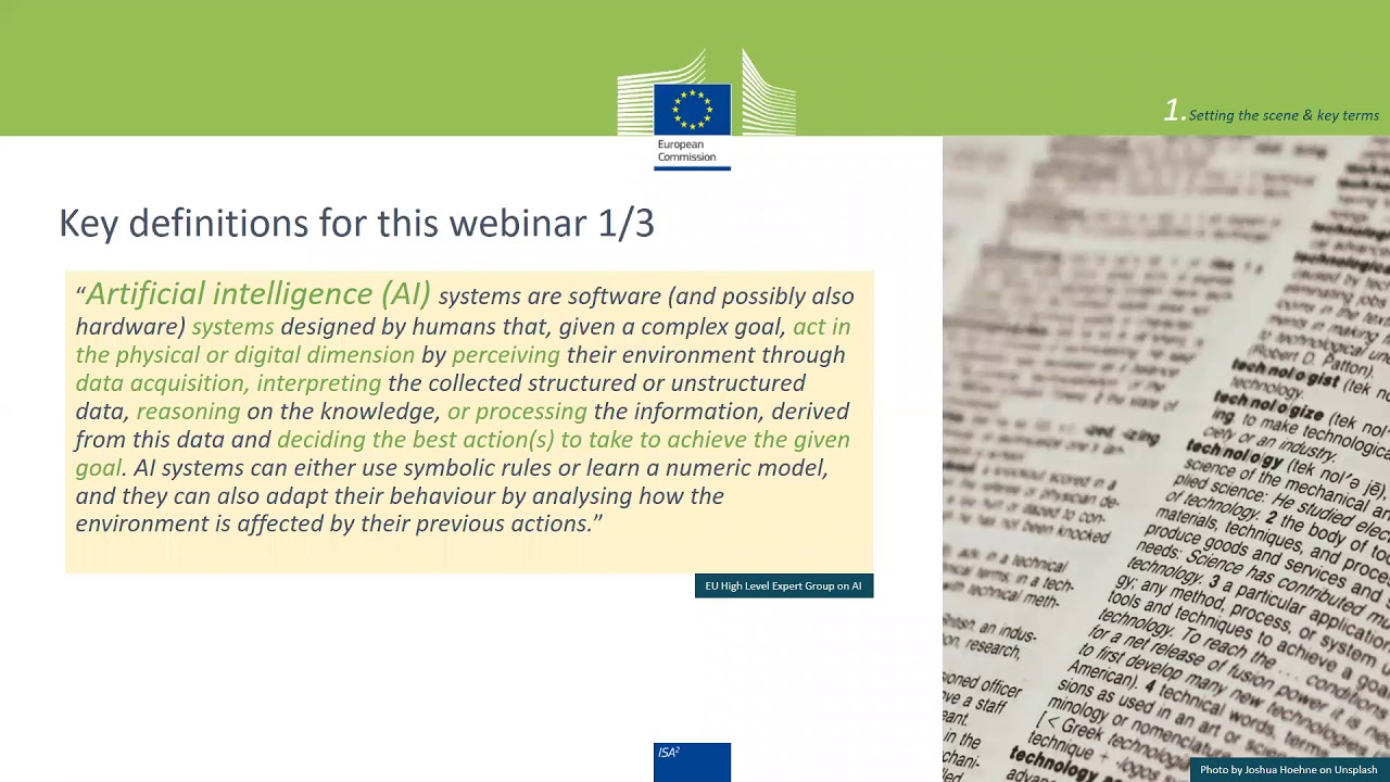
• Introduction – Setting the scene & key terms
• GeoAI – Origins, present & future trends – research areas and applications
• Enabling GeoAI – Converging political & technical environments
• GeoAI applied – Demonstrating mounting relevance in key public policy areas
• Interoperability efforts and challenges
• Key take-away messages and conclusions
————————————————————————————————————————————
Supporting slides: https://joinup.ec.europa.eu/collection/elise-european-location-interoperability-solutions-e-government/document/presentation-geospatial-data-and-artificial-intelligence-deep-dive-geoai
Webinar’s details: https://joinup.ec.europa.eu/collection/elise-european-location-interoperability-solutions-e-government/event/elise-webinar-geospatial-data-and-artificial-intelligence-deep-dive-geoai
Find more information on the ELISE activities and webinars in the dedicated JoinUp space: https://joinup.ec.europa.eu/collection/elise-european-location-interoperability-solutions-e-government/elise-webinars-series
source